


ปัจจัยที่ทําให้เกิดภัยพิบัติดินถล่ม ได้แก่ ลักษณะภูมิประเทศ ลักษณะทางธรณีวิทยาและปฐพีวิทยา ลักษณะการใช้ที่ดิน และลักษณะสภาพภูมิอากาศ
The factors that cause landslide disasters are topographical features, geological and soil characteristics, land use characteristics, and climate characteristics.
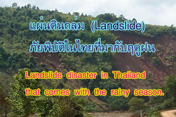
ภัยพิบัติจากแผ่นดินถล่ม (Landslide)
แผ่นดินถล่ม (Landslide) เป็นขบวนการเกิดเป็นการเคลื่อนที่ของแผ่นดินและวัตถุต่าง ๆ บนพื้นดิน การเคลื่อนที่จะเคลื่อนบนพื้นที่ลาดโดยอาจจะมีน้ำหรือความชื้นเป็นตัวหล่อลื่น ปรากฏการณ์แผ่นดินถล่มเป็นกระบวนการเคลื่อนที่ของแผ่นดินที่ถล่มตัวจากที่สูงลงสู่ที่ต่ำเนื่องจากเกิดการเสียความสมดุลในการทรงตัว ทำให้มีการปรับตัวไหลลงมาตามแรงดึงดูดของโลก
Landslides involve the movement of soil and various objects on the ground. The movement may occur on sloping terrain and may be influenced by water or moisture, providing lubrication. Landslides are characterized by the downward movement of soil from higher to lower elevations due to a loss of balance in the stability of the terrain. This results in the soil adjusting and flowing downward under the influence of gravity.
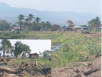
โดยทั่วไปแผ่นดินถล่มมักจะเกิดเวลามีฝนตกมากบริเวณภูเขา ซึ่งดินภูเขาต้องอุ้มนำไว้ ดินชั้นล่างมีการไหลซึมของน้ำช้ามาก ดินชั้นบนไม่เกาะกันเพราะอิ่มตัวด้วยน้ำ ประกอบกับมีความลาดเทในพื้นที่ระดับหนึ่งจึงจึงเกิดการพังหรือถล่มลงมา
Landslides often occur during heavy rainfall in mountainous regions where the soil on the slopes becomes saturated. The lower layers of soil experience slow water infiltration, while the upper layers, already saturated, lose their cohesion. Combined with a slope in the terrain, this imbalance leads to the collapse or sliding of the soil mass downward.
การเกิดแผ่นดินถล่มจะประกอบด้วย 4 ลักษณะของการถล่ม คือ
The occurrence of landslides comprises four characteristics of movement:
1. การตก (Falls) เป็นการหลุดออกจากที่ชันสูงและตกลงมาเป็นก้อนหรือมวลขนาดใหญ่
Falls: This involves the detachment of a mass from a steep slope, causing it to fall as a large block or mass.
2. การล้มหรือคว่ำของมวล (Topples) เป็นการล้มคว่ำหรือหมุนม้วนไปข้างหน้าทั้งก้อน
Topples: This refers to the forward tilting or rotation of a mass, causing it to fall or roll forward as a unit.
3. การไถล (Slides) เป็นการเคลื่อนที่ของมวลไปบนผิวชนิดใดชนิดหนึ่งเช่นผิวโค้ง ผิวเรียบ
Slides: This is the movement of a mass along a surface, such as a curved or flat surface.
4. การไหล (Flows) เป็นการเคลื่อนที่ของมวลตามแนวลาดชันโดยมีน้ำเป็นตัวช่วยให้เคลื่อน
Flows: This involves the movement of a mass along an inclined slope, often facilitated by the presence of water.
ปัจจัยและองค์ประกอบการเกิดภัยพิบัติแผ่นดินถล่ม ประกอบด้วย
The factors and components contributing to the occurrence of landslide disasters include:
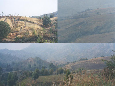
1. ลักษณะภูมิประเทศ เช่น ความลาดชัน ความยาวของความลาดชัน ระดับความสูงของพื้นที่
Topographical Features: such as slope steepness, length of slopes, and the elevation of the area.
2. ลักษณะทางธรณีวิทยาและปฐพีวิทยา เช่น องค์ประกอบของหินและดิน
Geological and Soil Characteristics: Such as the composition of rocks and soil.
3. ลักษณะการใช้ประโยชน์ที่ดิน ซึ่งจะมีผลต่อการปกคลุมพื้นดิน
Land Use Characteristics: Including the impact of land use practices on soil cover.
4. ลักษณะภูมิอากาศ เช่นปริมาณฝน
Climatic Conditions: Such as precipitation.
แนวทางการบรรเทาภัยจากการเกิดแผ่นดินถล่ม
ตามแนวคิดทางภูมิศาสตร์ การป้องกันและบรรเทาภัยจากแผ่นดินถล่มสามารถจำแนกตามพื้นที่ที่มีระดับความเสี่ยงภัยแตกต่างกันควรจะทำการวิเคราะห์พื้นที่ที่เสี่ยงต่อการเกิดแผ่นดินถล่ม ในการวิเคราะห์จำเป็นต้องพิจารณาปัจจัยพื้นฐานที่ทำให้เกิดแผ่นดินถล่มทั้ง 4 ปัจจัยข้างต้น เทคนิคในการวิเคราะห์จะใช้แผนที่ที่แสดงจุดที่เกิดแผ่นดินถล่ม นำมาเปรียบเทียบโดยซ้อนทับกับแผนที่ที่แสดงปัจจัยการเกิดแผ่นดินถล่มเพื่อพิจารณารายละเอียดและวิเคราะห์ศักยภาพที่เหมาะสมของแต่ละปัจจัยที่จะทำให้เกิดแผ่นดินถล่มซึ่งทำให้ทราบว่าบริเวณที่มีลักษณะเช่นเดียวกับพื้นที่ที่เคยเกิดแผ่นดินถล่มเป็นบริเวณที่เสี่ยงต่อการเกิดแผ่นดินถล่มซึ่งปัจจุบันได้มีการนำเอาเทคนิควิธีการด้านการจัดทำระบบสารสนเทศภูมิศาสตร์มาใช้งาน ทำให้สามารถวิเคราะห์พื้นที่ที่เสี่ยงต่อการเกิดแผ่นดินถล่มได้ชัดเจนขึ้น
We can classify strategies based on varying risk levels using geographical principles, landslide prevention, and mitigation. Analyzing landslide-prone areas requires consideration of fundamental factors, including the four mentioned factors. We use maps in analytical techniques to show landslide locations along with factors that contribute to landslides. The detailed examination and assessment of each factor's potential impact on landslides is made possible through this comparative analysis. When we identify areas resembling those where landslides have occurred in the past, it becomes clear which areas are at risk. GIS techniques are currently used to improve the analysis of landslide-prone areas. The integration helps identify areas prone to landslides with more clarity.
เมื่อรู้พื้นที่เสี่ยงต่อการเกิดแผ่นดินถล่มในระดับต่าง ๆ แล้ว สามารถกำหนดแนวทางในการป้องกันและบรรเทาการเกิดแผ่นดินถล่มได้โดยแยกเป็นมาตรการในแต่ละระยะดังนี้
Once areas susceptible to landslides are identified at various levels, prevention and mitigation strategies can be tailored accordingly. We categorize these strategies based on different phases as follows.