สาระภูมิศาสตร์

Thailand season: The factor behind the three seasons of Thailand – summer, rainy and winter seasons

อ่านเพิ่มเติม...

Map-perspective


แผนที่&GIS

นักแผนที่และนักสำรวจจะต้องปรับตัวเมื่อตำแหน่งมือถือปรากฏบนแผนที่และภาพถ่ายจากดาวเทียมในหน้าจอมือถือได้ถูกต้อง

อ่านเพิ่มเติม...

ข้อคิดเห็น

เรื่องเล่า

ขับรถเล่นสงกรานต์รอบคูเมืองเชียงใหม่เห็นเพื่อนต่างชาติและคนไทยเล่นสงกรานต์สาดน้ำกันอย่างสนุกสนาน 

อ่านเพิ่มเติม...

ภูมิประเทศ

พื้นผิวของประเทศไทย เมื่อแบ่งตามธรณีสัณฐานจะแบ่งได้ 8 ภูมิภาค

อ่านเพิ่มเติม...

ภูมิอากาศ

ฝนตกในวันที่ 9 และ 10 ธ.ค. 2566 ในวันที่ 11 ธ.ค. 2566 ไม่มีหมอก วันที่ 12 ธ.ค. 2566 ตอนเช้าอากาศเย็นเล็กน้อย ปรากฏมหมอกบาง ๆ รอบๆ บ้านภูมิ-เพียง แม่ริม เชียงใหม่

Rain on December 9 and 10, 2023. December 11, 2023, no fog. On December 12, 2023, the morning was slightly cold. The fog appeared around the BaanPoomPiang Mae Rim Chiang Mai.

อ่านเพิ่มเติม...

ภัยพิบัติ

The factors that cause landslide disasters are topographical features, geological and soil characteristics, land use characteristics, and climate characteristics.

อ่านเพิ่มเติม...

แนวคิดทฤษฎี

ผลกระทบจากพายุฤดูร้อนที่ควรศึกษาและจัดการ

อ่านเพิ่มเติม...

The factors that cause landslide disasters are topographical features, geological and soil characteristics, land use characteristics, and climate characteristics.


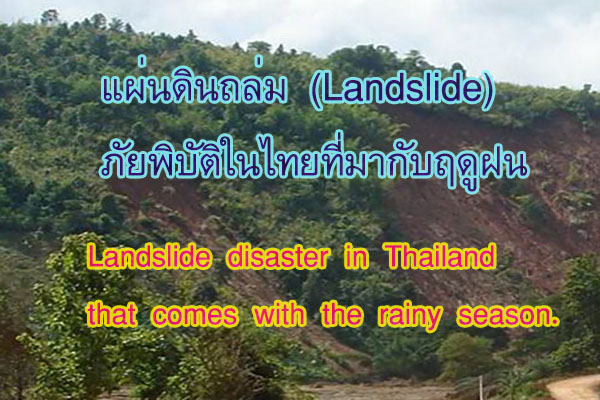
Landslides involve the movement of soil and various objects on the ground. The movement may occur on sloping terrain and may be influenced by water or moisture, providing lubrication. Landslides are characterized by the downward movement of soil from higher to lower elevations due to a loss of balance in the stability of the terrain. This results in the soil adjusting and flowing downward under the influence of gravity.


Landslides often occur during heavy rainfall in mountainous regions where the soil on the slopes becomes saturated. The lower layers of soil experience slow water infiltration, while the upper layers, already saturated, lose their cohesion. Combined with a slope in the terrain, this imbalance leads to the collapse or sliding of the soil mass downward.


The occurrence of landslides comprises four characteristics of movement:

1.       Falls: This involves the detachment of a mass from a steep slope, causing it to fall as a large block or mass.

2.       Topples: This refers to the forward tilting or rotation of a mass, causing it to fall or roll forward as a unit.

3.      Slides: This is the movement of a mass along a surface, such as a curved or flat surface.

4.      Flows: This involves the movement of a mass along an inclined slope, often facilitated by the presence of water.


The factors and components contributing to the occurrence of landslide disasters include:

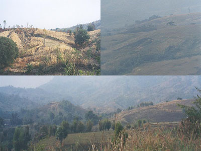
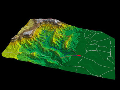
1.      Topographical Features: such as slope steepness, length of slopes, and the elevation of the area.

2.       Geological and Soil Characteristics: Such as the composition of rocks and soil.

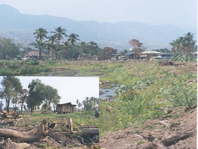
3.      Land Use Characteristics: Including the impact of land use practices on soil cover.

4.       Climatic Conditions: Such as precipitation.


We can classify strategies based on varying risk levels using geographical principles, landslide prevention, and mitigation. Analyzing landslide-prone areas requires consideration of fundamental factors, including the four mentioned factors. We use maps in analytical techniques to show landslide locations along with factors that contribute to landslides. The detailed examination and assessment of each factor's potential impact on landslides is made possible through this comparative analysis. When we identify areas resembling those where landslides have occurred in the past, it becomes clear which areas are at risk. GIS techniques are currently used to improve the analysis of landslide-prone areas. The integration helps identify areas prone to landslides with more clarity.

              Once areas susceptible to landslides are identified at various levels, prevention and mitigation strategies can be tailored accordingly. We categorize these strategies based on different phases as follows.


Long-term measures for managing landslide-prone areas include:

1.       Clearly defining land-use boundaries.

2.       Establishing regulations and guidelines for area management.

3.       Allocating budgets for constructing various structures to mitigate landslide intensity.

4.       Planting suitable and fast-growing ground cover vegetation.

5.       Promoting awareness and providing education on landslide prevention and mitigation.

6.      Monitoring weather forecasts.

Short-term or emergency measures for managing landslide-prone areas include:

1.      Identifying areas at risk of landslides.

2.       Implementing measures and defining methods to manage areas prone to landslides.

3.       Urgently undertaking improvements in areas susceptible to landslides.

4.      Establishing training programs and providing knowledge to disaster relief units.

5.      Expedited relocation of communities at high risk of landslides.

6.       Exploring methods or guidelines for developing and installing warning systems. 


Thailand has many mountainous regions that are prone to landslides. Heavy rainfall can cause soil erosion, resulting in the displacement of soil that is carried by water, ultimately causing damage downstream. The southern region of Thailand experiences noticeable and significant effects from landslides.

For example, on January 5-6, 1975, a landslide occurred in Hin Tok Subdistrict, Ron Phibun District, Nakhon Si Thammarat Province. This event resulted in the destruction of 85 houses, with 24 fatalities and 35 missing persons. Another notable incident took place from November 26 to December 4, 2531 (1988) in Krathun Subdistrict, Phipun District, Nakhon Si Thammarat Province. A landslide caused soil and trees to collide with houses, resulting in damage to 2,621 houses, 236 fatalities, and 305 missing persons.


Comments powered by CComment

สาระภูมิศาสตร์

  • ตามทฤษฎี วัฏจักรของการกัดกร่อนของ วิลเลียม มอร์ริส เดวิส หลังจากเปลือกโลกยกตัวขึ้นก็เกิดขบวนการกัดเซาะของน้ำ

    อ่านเพิ่มเติม...

แผนที่ & GIS

  • มาตราส่วนจะสัมพันธ์ในการทำ Generalization และ Symbolization ในแผนที่

    The scale plays a crucial role in the processes of generalization and symbolization in cartography.

    อ่านเพิ่มเติม...

เล่าหลากมุม

  • นักท่องเที่ยว แรงงานต่างด้าว ในเมืองเชียงใหม่ 

    Travelers and foreign workers in the city of Chiang Mai.

    อ่านเพิ่มเติม...
JSN Epic is designed by JoomlaShine.com