แผนที่&GIS

ราชบัณฑิตยสถาน (2549,258) ให้ความหมายของระบบสารสนเทศภูมิศาสตร์ (Geographic Information System) ว่า ระบบข้อมูลข่าวสารที่เชื่อมโยงกับค่าพิกัดภูมิศาสตร์....." แล้วเข้าใจข้อมูลที่เชื่อมโยงกับค่าพิกัดภูมิศาสตร์ว่าอย่างไร

อ่านเพิ่มเติม...

Map-perspective


เรื่องเล่าจากนักภูมิศาสตร์

ผลกระทบจากพายุฤดูร้อนที่ควรศึกษาและจัดการ

อ่านเพิ่มเติม...

ข้อคิดเห็น

สาระภูมิศาสตร์-promote-right

ปรากฏการณ์ เอลนีโญ – ลานิญา ถูกพูดถึงบ่อยและมากขึ้น ในฐานะนักภูมิศาสตร์คงต้องอธิบายเพื่อให้ง่ายต่อการเข้าใจอีกครั้ง

The phenomenon of El Niño-La Niña is increasingly and frequently discussed. As a geographer, it is essential to provide explanations for better understanding once again.

อ่านเพิ่มเติม...

โลกของแผนที่

หากเป็นผู้ใช้หรือผู้ผลิตแผนที่ต้องรับรู้และเข้าใจรายละเอียดประจำขอบระวาง รายละเอียดประจำขอบระวางที่ดีจะช่วย

อ่านเพิ่มเติม...

TechnologyGIS

ราชบัณฑิตยสถาน (2549,258) ให้ความหมายของระบบสารสนเทศภูมิศาสตร์ (Geographic Information System) ว่า ระบบข้อมูลข่าวสารที่เชื่อมโยงกับค่าพิกัดภูมิศาสตร์....." แล้วเข้าใจข้อมูลที่เชื่อมโยงกับค่าพิกัดภูมิศาสตร์ว่าอย่างไร

อ่านเพิ่มเติม...

เครื่องมือทางภูมิศาสตร์

IoT (Internet Of Thing), Big Data, Data Analytic และ ปัญญาประดิษฐ์ (AI) เป็นแค่แนวคิดและเทคโนโลยี บางครั้งเป็นความลับ บางครั้งสามารถค้นหา เรียนรู้ได้อย่างเปิดเผย

อ่านเพิ่มเติม...

สารบัญ

Improving map data in GIS with field data surveys using maps. We need consideration to determine the type of data feature.

Mapping is a representation of the characteristics of the Earth's surface, either globally or in specific regions, achieved through the process of scaling down and using symbols to represent various details present on the terrain. It is crucial to understand the features of a map, which include.

1. Transferring the characteristics of the Earth's surface to a flat plane.
2. Scaling down.
3. Symbols.

Consequently, it is essential to grasp the importance of recording data on the map throughout all three main components. Understanding minimization or scale is essential for accurately mapping the earth's surface onto a flat map using symbols. In this context, scale represents the ratio between map distances and actual distances on the ground, with the map distance set as 1 unit.


The map scale is 1:1,000, meaning that 1 unit on the map is equal to 1,000 units on the ground. For example:


If it measures 1.2 inches on the map, that's equal to 1.2 x 1,000 inches, or 1,200 inches, which is 100 feet.


If it measures 10 centimeters on the map, that's equal to 10 x 1,000 centimeters, or 10,000 centimeters, which is 1 kilometer.


Improving map data in geographic information systems with field data surveys using maps. We need consideration to determine the type of data feature. The feature type in the country that will be imported into the mapping system, whether in hard copy or digital map format, can be categorized into three main types.

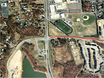
1. Positional Data (Point): Data without dimensions of width and length.

2. Route Data (Line): Data with both length and direction.

3. Area Data (Area/Polygon): Data with dimensions of width, length, and area.


สาระภูมิศาสตร์

  • ฝนตกในวันที่ 9 และ 10 ธ.ค. 2566 ในวันที่ 11 ธ.ค. 2566 ไม่มีหมอก วันที่ 12 ธ.ค. 2566 ตอนเช้าอากาศเย็นเล็กน้อย ปรากฏมหมอกบาง ๆ รอบๆ บ้านภูมิ-เพียง แม่ริม เชียงใหม่

    Rain on December 9 and 10, 2023. December 11, 2023, no fog. On December 12, 2023, the morning was slightly cold. The fog appeared around the BaanPoomPiang Mae Rim Chiang Mai.

    อ่านเพิ่มเติม...

แผนที่ & GIS

  • จัดเก็บข้อมูลภาคสนามด้วยแผนที่เพื่อจัดทำและนำเสนอข้อมูลในระบบสารสนเทศภูมิศาสตร์ จำเป็นต้องพิจารณากำหนดชนิดของคุณลักษณะข้อมูล (Feature Type)

    อ่านเพิ่มเติม...

เล่าหลากมุม

JSN Epic is designed by JoomlaShine.com